
The Ecological Restoration Institute welcomes you to explore the ponderosa pine forest restoration demonstration site at Fort Tuthill County Park, a living classroom in your backyard. Technology, history, and science converge in this interactive program that takes participants through an example of how forest restoration can reduce wildfire risk, improve ecosystem health, and reconnect us with the historical structure of ponderosa pine forests in northern Arizona.
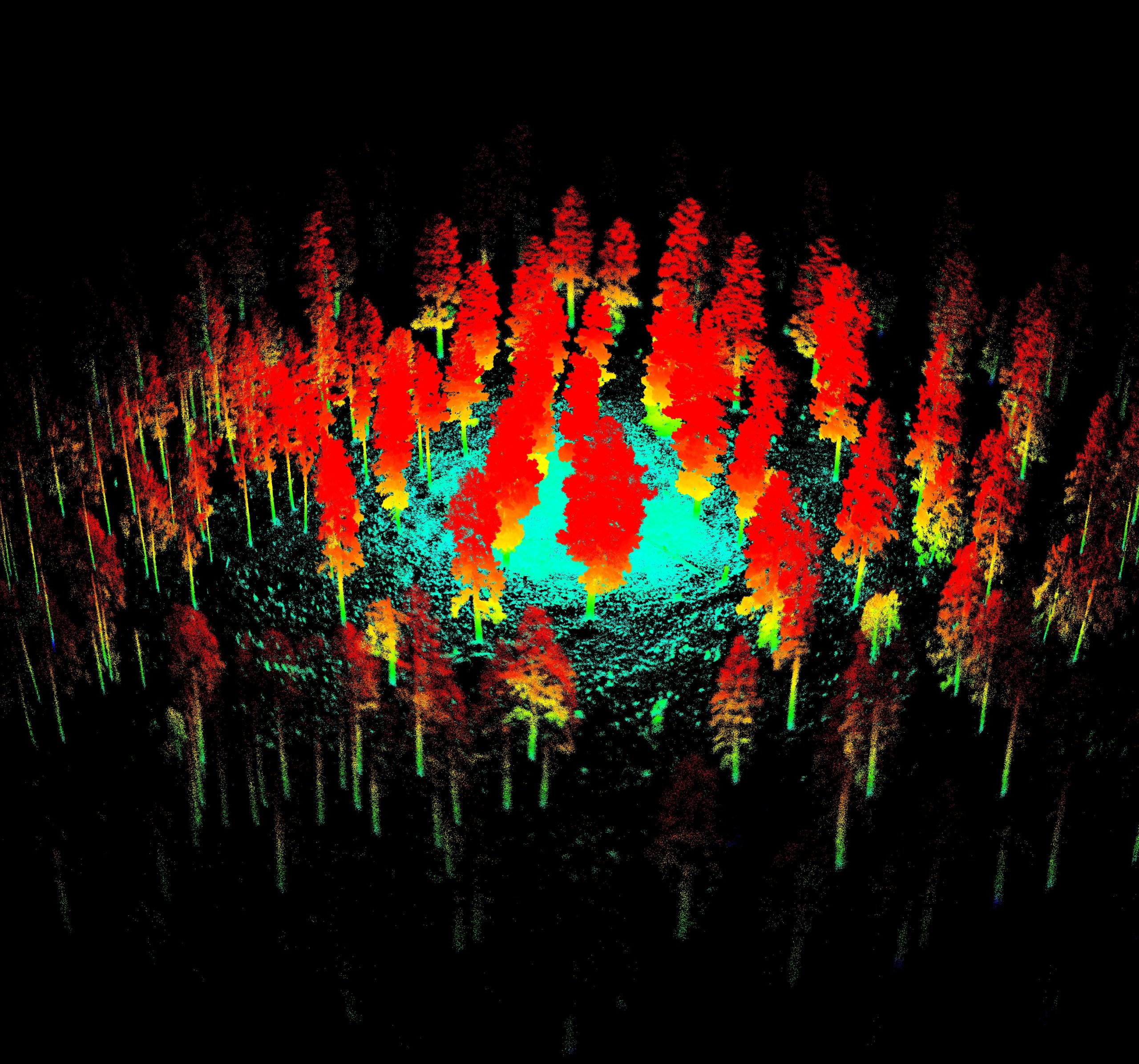
Participants will learn how scientists combine field data and a technology called LiDAR (Light Detection and Ranging) to guide restoration decisions and visualize forests in three dimensions. LiDAR is a remote sensing tool that sends out laser pulses to create detailed 3D maps of forests, helping us understand their structure, monitor changes, track regrowth, and assess responses to disturbances like wildfire.
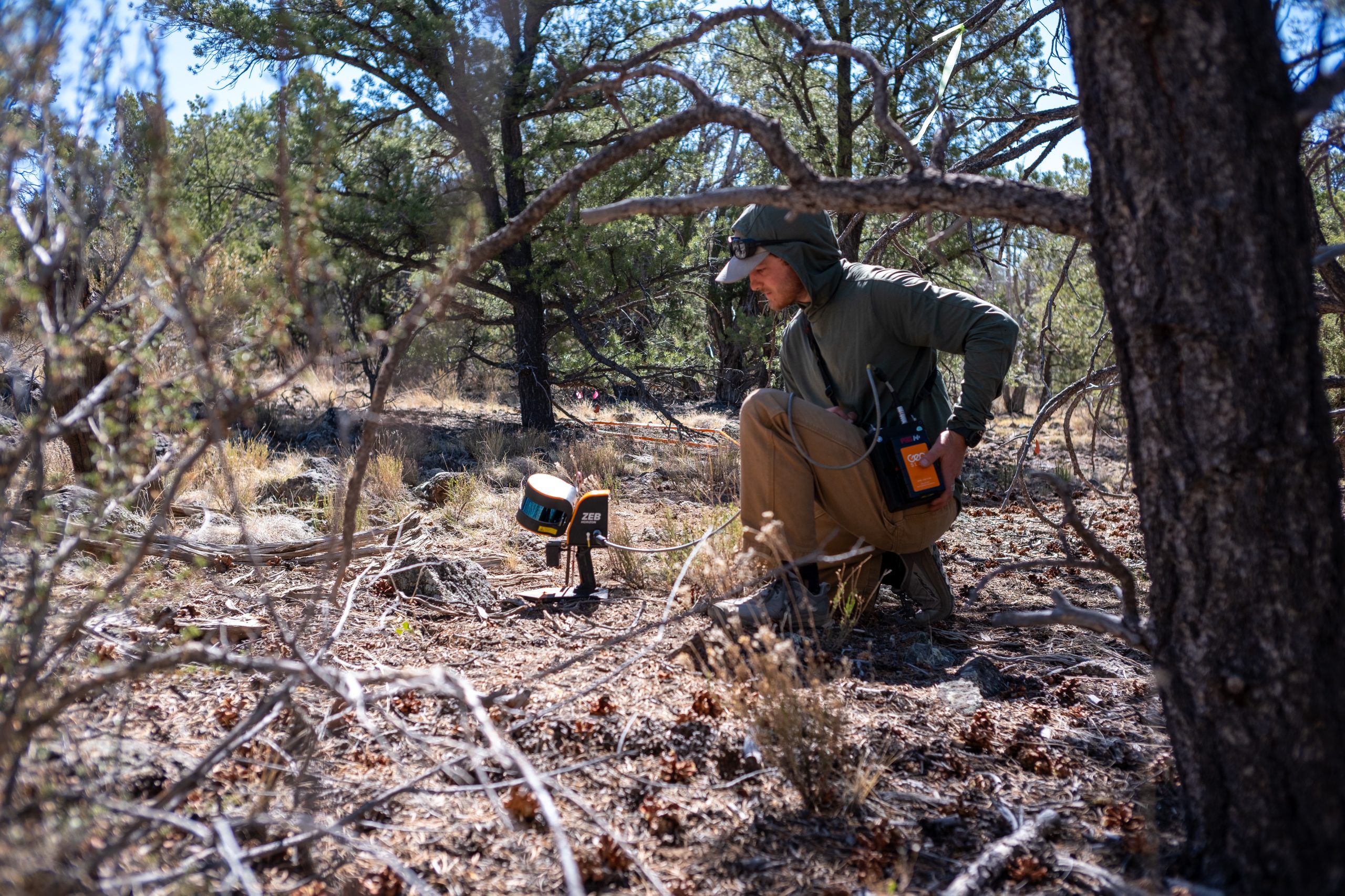
At this site, we are using Terrestrial LiDAR Scanning (TLS), which involves setting up a scanner on the forest floor to capture extremely detailed information about nearby trees, logs, understory plants, and other surface fuels. TLS gives us a close-up, high-resolution view of the forest from the ground, making it perfect for detecting subtle changes in fuels and vegetation. This is different from aerial/airborne LiDAR, which collects data from planes or drones and offers a broader, top-down view.
This site demonstrates how high-resolution TLS data can directly inform restoration– helping managers design treatments that are practical, targeted, and based on real forest conditions. TLS also helps us monitor how the forest changes after treatments over time, making restoration more informed and effective.
Visitors will walk through a 13-acre area where restoration thinning was designed by interpreting old stumps, logs, and legacy trees that tell a story of what this forest once was. Using these clues, researchers and forest managers were able to reconstruct historic tree density and arrangement. The goal was to restore the stand’s structure and function to resemble conditions prior to Euro-American settlement, when frequent surface fires shaped resilient, fire-adapted forests. These fires maintained a dynamic mosaic of widely spaced large ponderosa pines interspersed with small groups of trees and open, grassy areas.
Watch the scanning process in real time and see how LiDAR captures information about tree arrangement, size, and canopy layers with remarkable precision. We will also discuss how researchers use this data to estimate historical forest conditions, plan restoration treatments, and monitor the forest’s response to thinning, fire, and climate change over time.
The Fort Tuthill demonstration site is a collaborative effort between Coconino County Parks and Recreation, the Ecological Restoration Institute, Greater Flagstaff Forests Partnership, the Coconino National Forest, and several other local and state partners. It has become a model for community-based restoration and is a favorite stop for students, policymakers, and curious hikers interested in learning how proactive forest management can improve ecological health and safeguard our communities, water supplies, and infrastructure from the growing threat of wildfire. Educational kiosks with original illustrations guide visitors through the concepts of fire ecology, forest restoration, and the importance of proactive forest management in protecting our communities and watersheds.


 Board member, Adam Marsh, and lead paleontologist at Petrified National Forest, works with a team of scientists to uncover an approximately 300 million-year-old fossil skeleton discovered at Canyonlands National Park in Utah (June 2024)
 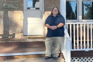 Board member, Kathy Farretta, joins the Arizona Historical Society as the Pioneer Museum’s new Museum Manager, a position that was vacant for nearly five years. (December 2025)