
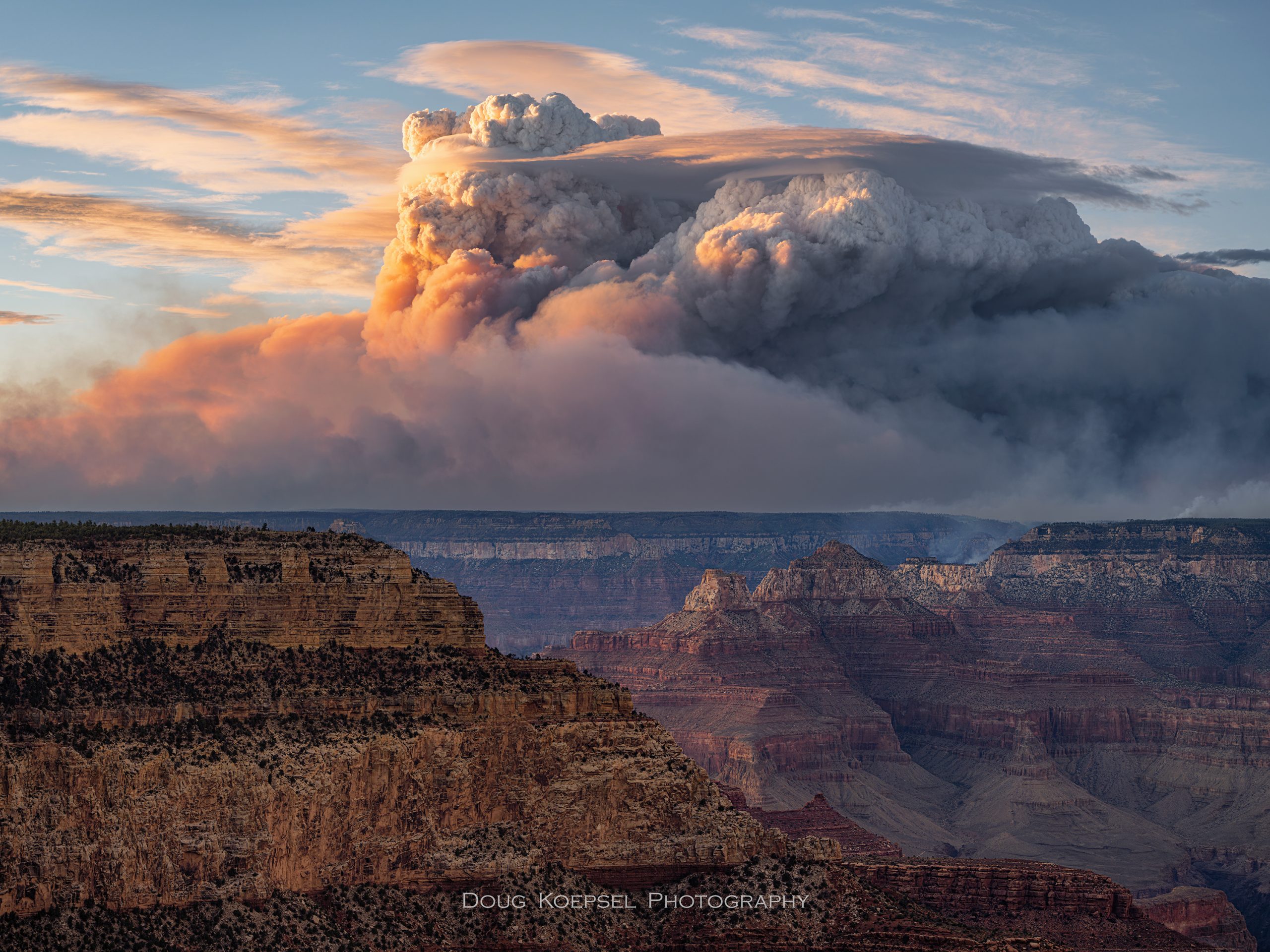
Wildfires are dramatic, devastating, and increasingly common, but understanding them is just as fascinating as witnessing their power. On the North Rim of the Grand Canyon, the Dragon Bravo Fire exploded into public awareness in mid-July, consuming historic structures and threatening the surrounding landscape. But the fire’s initial devastation was only the beginning. Over the following weeks, extreme weather conditions fueled its explosive growth, ultimately making it one of the largest wildfires in Arizona’s recorded history.
In my upcoming presentation, I will take attendees behind the scenes of this extraordinary event, exploring the meteorological factors, scientific insights, cutting-edge technology, and dedicated professionals that all play critical roles in wildfire prediction and response. You’ll gain a deeper understanding of how modern weather science intersects with fire behavior, offering both a thrilling and practical perspective on extreme events.
Among those on the front lines are Incident Meteorologists (IMETs)—specialized weather experts deployed to large fires. IMETs provide on-the-ground forecasts and real-time updates to fire management teams, informing critical safety and operational decisions. Their work is one piece of the broader wildfire science puzzle, but it’s a vivid example of how meteorology directly shapes firefighting strategies.
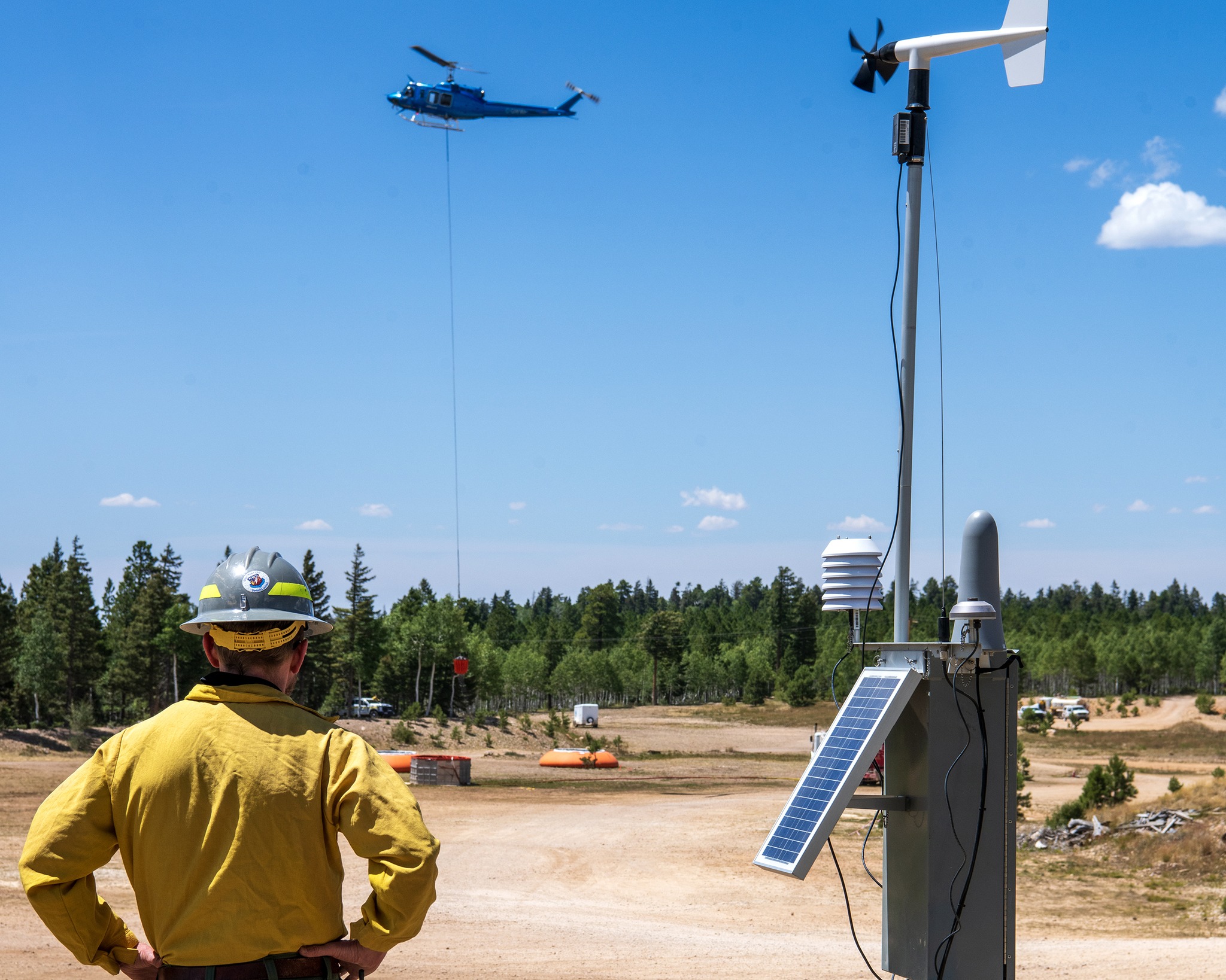
Credit: NOAA/ NWS Photo by Robert Hyatt
But the hazards don’t end when the flames die down. Large burn scars (like the one left by the Dragon Bravo Fire) remove vegetation and leave soils hydrophobic, meaning they repel water. Even moderate rainfall can trigger dangerous flash flooding and debris flows. Bright Angel Creek is particularly vulnerable, with the potential for flash floods and debris flows that could threaten hikers and critical infrastructure. I’ll discuss how forecasters monitor these threats, issue timely warnings, and work with other agencies to protect lives during this dangerous “second act” of wildfire impacts.
During the session, I will cover:
The Weather Behind the Fire: What atmospheric conditions contributed to the fire’s rapid expansion? We’ll explore how temperature, humidity, wind, and topography created a violent storm for wildfire growth.
Fire Behavior in Real Time: Using satellite imagery, ground observations, and numerical models, you’ll see how fire scientists and operational meteorologists track and predict fire spread.
Technology and Forecasting Tools: From advanced radar to real-time data assimilation, we’ll examine the tools meteorologists and fire managers use to anticipate wildfire behavior and make life-saving decisions.
After the Fire…Flood Risks: How burn scars transform into flash flood hot spots, and how forecasters prepare for this ongoing hazard.
This presentation is about more than charts and models, it’s about the science of extreme phenomena and the human and ecological stories they shape. Whether you’re a weather enthusiast, a fire management professional, or simply curious about how extreme events are understood and managed, this is a chance to see wildfire science in action and learn the story of the Dragon Bravo Fire and the challenges that follow long after the last ember fades.
Written by Brian Klimowski, Meteorologist in Charge at US National Weather Service. (Photo header credit to: Doug Koepsel)
Attend “The Day the Dragon Rose: A Fire Weather Story” on Tues. Sept. 23rd, 6 p.m. at Lowell Observatory. Free.


 Board member, Adam Marsh, and lead paleontologist at Petrified National Forest, works with a team of scientists to uncover an approximately 300 million-year-old fossil skeleton discovered at Canyonlands National Park in Utah (June 2024)
  Board member, Kathy Farretta, joins the Arizona Historical Society as the Pioneer Museum’s new Museum Manager, a position that was vacant for nearly five years. (December 2025)